
Geologic History Of The Eagle Rock Ranch
AND SURROUNDING ENVIRONS
PREFACE
Why study the geologic history of a place? What difference does it make? Who cares? And if so, why? These are fair questions for most.
History of any kind, whether it be cultural, biological or geological, matters for the simple reason that it is the pathway to the present. Knowing where we started and how we got to this point helps us better understand where we are now and perhaps gives us a better sense of where we are headed. Understanding that kind of history gives us perspective to better view the present. It is also a key element in establishing our place.
For a naturalist and student of the land such as Aldo Leopold, an area’s geologic history serves as the foundational narrative that defines the stability, potential, and "personality" of the land. He believed that true ecological understanding required "reading the land" across vast spans of time, moving beyond the "constricted present" to appreciate the millennia of evolutionary and geologic processes that created the modern environment. He once told a group of students that if they learned to “read the land” he would have no concerns about what they might do to it. Ultimately, he felt that his Land Ethic could emerge and flourish only when humans recognized their "kinship" with other creatures in the "odyssey of evolution"—a journey shaped by geologic time and biological progress.
Aldo Leopold composed one of his most eloquent essays, Marshland Elegy, after visiting a Wisconsin farmer’s marsh in the early 1930’s to view an endangered pair of cranes. This visit ultimately led to his subsequent purchase of a nearby barren, abused 80-acre piece of abandoned farmstead upon which he began a storied restoration effort culminating in the authorship of the seminal conservation book, A Sand County Almanac. In this poignant masterpiece of an essay, he writes:
“Our ability to perceive quality in nature begins, as in art, with the pretty. It expands through successive stages of the beautiful to values as yet uncaptured by language. The quality of cranes lies, I think, in this higher gamut, as yet beyond the reach of words.
This much, though, can be said: our appreciation of the crane grows with the slow unraveling of earthly history. His tribe, we now know, stems out of the remote Eocene. The other members of the fauna in which he originated are long since entombed within the hills. When we hear his call we hear no mere bird. We hear the trumpet in the orchestra of evolution. He is the symbol of our untamable past, of that incredible sweep of millennia which underlies and conditions the daily affairs of birds and men.
And so they live and have their being – these cranes – not in the constricted present, but in the wider reaches of evolutionary time. Their annual return is the ticking of the geologic clock.”
These passages are among Leopold’s most eloquent in articulating how the perspective achieved by studying geological and biological history and the “slow unraveling” of the history of the earth and the story of life on this planet influences – or should influence – our values and ethics toward land use – one entailing not only a spatial and esthetic appreciation, but a temporal one as well.
In that spirit of “slowly unraveling” the geological, biological and cultural history of the Eagle Rock Ranch and its surrounding environs, we also gain a better perspective and understanding of our place of dwelling in the sense of German philosopher Martin Heidegger. Heidegger’s concept of “dwelling” isn’t so much about owning a home or renting an apartment, but rather becoming rooted in a place. About forming an accommodating relationship with both space and place that unfolds and develops over time, and through care, repetition, and an understanding of how all that surrounds you came to be. Professor Robin Wall Kimmerer would add the element of reciprocity with the plants and wildlife that are present as well.
When Henry David Thoreau wrote in Walden that he felt that he had “traveled a great deal in Concord,” he meant that through his extensive “sauntering” through his landscape, he found a universe of intellectual, natural, and spiritual exploration within his hometown, making extensive physical travel unnecessary. He was contrasting his measured, deliberate and examined life with the hectic, unthinking, and materialistic lives of his neighbors.
So, it is with that purpose in mind, i.e., to gain a deeper understanding of the area and wildlife around us, and to further our attempts to properly dwell in this particular landscape and community, we set out to determine just how this land came to be and how we along with our fellow flora and fauna might have our being – not only “in the constricted present – but in the wider reaches of evolutionary time.”
“And this our life, exempt from public haunt, finds tongues in trees, books in the running brooks, sermons in stones, and good in everything. I would not change it.” - William Shakespeare, As You Like It, Act II, Scene I
The concept of Deep Time¹ is very difficult to understand. It refers to the scope and magnitude of geologic time that spans billions of years, both far beyond the scale of human experience and defying comprehension. It is within this framework that we must endeavor to understand the underpinnings of our world today, how it formed, how it developed and how it changed over an incredible amount of time to where it is today. And to really understand our environment today, we must at least try to comprehend how we arrived at this place. The geologic record, as expressed in rock types, composition, fossils, and land forms, speaks to us at length. All we need is our curiosity and a willingness to observe and think critically. And so our journey begins – skipping for now, at least, the origin of our planet but focusing instead on our little corner of the world, the Eagle Rock Ranch, as it sits within South Park and the State of Colorado.
PRECAMBRIAN PROTEROZOIC EON – (2.5 Ga – 541 Ma).
At one time, the part of the United States that includes what is now South Park and the Eagle Rock Ranch was south of the equator and was a series of islands – an archipelago of sorts - in a large ocean. The Proterozoic eon (meaning “earlier life”) is the eon of time after the Archean eon and ranges from 2.5 billion years old to 541 million years old. During this time, the central parts of most of the continents (including the nascent continent of Laurentia) had formed into the supercontinent Columbia and the plate tectonic process was underway. Tectonic plates were shifting, continental rifting and subduction had begun, and the ancient cores of the continents moved over wide areas of the globe, accumulating smaller fragments of crust and sometimes colliding with other large landmasses. This process did not happen fast (as we understand that term) but rather very slowly over the course of hundreds of millions of years.
During this time and in this context, between approximately 1.78 and 1.65 billion years ago (again during the Proterozoic)², a series of volcanic arcs – similar to what we see today in Southeast Asia – rafted towards and collided with the fledgling continent of Laurentia and were subsequently subducted thereunder together with seabed sediments (essentially soils and rocks) following initial accretion. This accretion and subsequent subduction is referred to as the Yavapai accretion involving the Yavapai province and helped expand the southern and southwestern margin of the nascent Laurentia continent, which was then situated at a low to moderate Southern Hemisphere latitude.
It was a time of sun, earth, wind, rock and water – no life had yet developed on the planet.
The suture zone created by the collision of the existing older Precambrian rocks of NW Colorado and Wyoming (2.7 Ga) with the younger Yavapai archipelago (1.7 Ga), trending in a southwesterly-northeasterly direction from NW Colorado into SE Wyoming, is referred to as the Cheyenne Belt. As a result of this collision and subsequent suturing of landscape, the foundation of present-day Colorado was formed. The rocks forming this landscape were originally volcanic and sedimentary (identifying the original source as island arcs), but as they were subducted deep (upwards of 14-15 miles below sea level) under the existing Laurentia continent, they were subsequently thoroughly transformed (metamorphosed) and folded by extraordinary heat and incredible pressure into metamorphic gneiss (upwards of 68 tons/square in).
Concurrently with the very slow but steady subduction process, deep-seated metamorphosis, and subsequent very gradual uplift, these rocks were injected at great depth by a series of molten granitic intrusions, each of which intruded into the earlier intrusion(s), all of which were lifted together, and currently are all exposed at various locations either on the Eagle Rock Ranch or in the immediate vicinity.
The first of these is called the Boulder Creek granitic intrusive series that was injected at great depth (approx. 12 miles) and at great temperature almost 1,700 million years ago. These granitic rocks reflect a foliated, banded appearance and are often referred to as “tonalite” (salt and pepper look) and “granodiorite.” The second significant intrusion occurred approximately 1,400 million years ago, at a much shallower depth due to the intervening years of uplift. This is referred to as the “Silver Plume” granite, consisting of much finer grains and more muscovite mica, etc. Still later, after another 400 million years – and at approximately 1.0 billion years age, the more familiar coarse-grained, pink-colored “Pikes Peak Batholith” was intruded just a few miles below the existing surface. Igneous rocks in Colorado that are of this age occur only in and around Pikes Peak, the associated Rampart Range, and the Tarryall Mountains – including the Eagle Rock Ranch.
Radioactive dating techniques tell us that the Pikes Peak granite was intruded several miles below the surface about 1 billion years ago. It is now exposed at the surface and indeed comprises peaks such as Pikes Peak that stands at over 14,000 feet in elevation. Where is the several miles of soil and rock that once overlay this granite? Moreover, just east of the Eagle Rock Ranch (and west of Colorado Springs) lies the “Great Unconformity” consisting of 1 Ga old granite overlain directly by Cambrian-aged (500 Ma) Sawatch Sandstone. The geologic record of 500 million years is missing. What happened to it?
Indeed, helium/thorium ratio analyses tells us that the material overlying the Pikes Peak granite was stripped in large-scale erosion events from above this granite between 1 billion years ago and 700 million years ago. Moreover, we know from radioactive dating that the Pikes Peak batholith was intruded several miles below the earth’s surface. Yet sandstone is deposited at sea level. How did the two meet up?
These erosion events line up with the time frame in which the supercontinent Rodinia was forming (about 1 Ga) and seem perhaps driven by the formation and dissolution of supercontinents that uplift massive amounts of rock over long periods of time. Therefore, many researchers believe that the dissolution of Rodinia was related to the uplift of the Pikes Peak granite intrusion – essentially the creation of an entire mountain range - and subsequent large-scale erosion that removed the miles of overburden and eroded the land to sea level where it became overlain with the sedimentary Sawatch sandstone. Fluctuating sea levels have played a part as well as rising ocean water could have met the eroding landscape part-way. In any event, as the newly-born continent began to drift, geological processes of wind and water erosion began to break it down such that the characteristics of the Sawatch formation tell us that it was deposited in a beach-like setting. The juxtaposition of 1 Ga old granite immediately underneath 500 Ma sandstone thus tells us that by 500 million years ago – the once-magnificent mountain range had been completely eroded away to sea level (perhaps abetted by the intense global warming that followed the sudden melting of the worldwide glacial ice approximately 600 Ma) and the resultant landscape had been reduced to beach-front property at the edge of a great sea. Unlike the lush vegetated slopes of today’s mountains, Colorado’s Precambrian mountains and beaches did not have a single plant growing on them as plant life had not yet materialized on the landscape. That changed during the Cambrian period that followed.
PALEOZOIC ERA – (541 Ma – 251 Ma).
Cambrian – Ordovician – Silurian – Devonian - Mississippian Periods – (541 Ma – 318 Ma). The next 220 million years comprised the Cambrian through the Mississippian periods and things were fairly quiet around the land that would become the Eagle Rock Ranch. The land lay just about on (or very near) the equator and mostly underwater where Manitou limestone (as you find in the nearby Cave of the Winds) was first deposited followed by widespread shallow sea deposition of marine mudstones and limestones. In the Ordovician period, North America dipped slightly below the equator, and shifting shorelines deposited sands in central Colorado, near Florence, that contain an incredible variety of creatures living in an estuarine environment, including fossils of one of the earliest known vertebrates – a primitive, jawless fish called agnathids. In the Mississippian Period, North America and Greenland (still slightly south of the equator) collided with Europe and other continental pieces to form the northern supercontinent Laurasia.
Pennsylvanian Period – (318 Ma – 299 Ma). The relative peace and quiet of the early Paleozoic Era ended thereafter at the start of the Pennsylvanian period when the supercontinent Pangea was being assembled. Gondwanaland collided with the North American continent in the vicinity of what is now Texas, and although the collision did not directly impact Colorado, the resulting stress raised both the land and a chain of mountainous islands referred to as the Ancestral Rocky Mountains. These mountains were located in roughly the same location as the modern Rockies and rose over a period of approximately six million years, followed by another 150 million years of erosion into gigantic alluvial fans constituting the Fountain Formation, revealed today along the Front Range in such features as Red Rocks Amphitheatre, Garden of the Gods, and the Flatirons in Boulder. The formation extended west, clear over and on top of the existing ranch, where it is known as the Maroon Formation (due to some subtle differences), and is exposed in certain places in Park County (occupying the low-lying valley just west of Red Hill Pass, for example), between Vail Pass and Avon along I-70, and forms the Maroon Bells outside Aspen, Colorado. The differential erosion of these rocks, as displayed today, is revealed in the ledges that can be seen in the ski runs of Vail – indeed, Vail has a ski run named “Ledges.”
Permian Period – (299 Ma – 251 Ma). The transition from the Pennsylvanian Period found the North American continent just slightly north of the equator, and followed by the Permian Period in which the previous shallow seas retreated and were replaced by a hot, arid landscape part of the supercontinent Pangaea, characterized by massive sand dune deserts such as the Lyons Sandstone and massive alluvial fans from the eroding Ancestral Rockies. The climate was harsh and dry, transitioning to tidal flats by the end of the period at which time occurred the Permian-Triassic extinction event which led to significant changes in sedimentation.
MESOZOIC ERA – (251 Ma – 66 Ma). The Mesozoic era consists of three distinct periods, the Triassic, the Jurassic, and the Cretaceous – each of which distinctly influenced life and geography on the planet including North America. Known as the Age of the Dinosaurs, the North American continent began the era at or near the equator and consisted of a lowland, warm, dry climate and finished the era having moved considerably to the northwest and in a mid-latitude position very close to its current position. During this period, Colorado was almost entirely covered by an inland sea and finally began its uplift at the beginning of the Laramide Orogeny event.
Triassic Period – (251 Ma – 200 Ma). The Permian-Triassic extinction event, also known as the Great Dying, was a world-wide extinction event that occurred approximately 250 Ma at the boundary of the Permian and Triassic Periods. It is the earth’s most severe known extinction event with the extinction of almost 60% of then-existing biological families, over 80% of marine species and 70% of terrestrial vertebrate species. It is also the greatest known mass extinction of insects.
The scientific consensus is that the extinction was caused by the flood basalt volcanic eruptions that created the Siberian Traps, which released massive amounts of sulfur dioxide and carbon dioxide into the atmosphere resulting in oxygen-starved, sulfurous oceans, elevated global temperatures and acidified oceans.
Colorado was still located near the equator in the interior of the Pangea supercontinent at this time, and its climate remained very hot and dry. In successive periods, wind erosion picked up sand and deposited it into formations such as the Lyons formation and the overlying Lykins formation. Dinosaurs appeared on the landscape and became the dominant life forms.
Jurassic Period – (200 Ma – 146 Ma). During the subsequent Jurassic period, Colorado was a low-lying, relatively flat, semi-arid plain with seasonally large meandering rivers, characterized by the Morrison Formation. It was a hotspot for giant dinosaurs, including Stegosaurus and Allosaurus, which thrived in the savanna-like environment filled with ferns, conifer, and cycads. Incidentally, the town of Morrison (located not far from the Eagle Rock Ranch) was the very first place that Jurassic dinosaurs were found in North America.
During the breakup of Pangea (beginning in the Early Mesozoic Era, roughly 200 million years ago), Colorado remained part of the North American plate (Laurentia), that was located in the tropics roughly at or slightly north of the equator and was migrating northwest. During this time, Colorado transformed from a dry, arid, wind-swept landscape into a low-lying region that was eventually submerged by a massive inland sea.
The Ancestral Rocky Mountains, which had formed in the late Paleozoic Era, were almost completely eroded away, leaving a relatively flat, low-lying landscape. As the supercontinent broke apart, global climates changed, bringing more moisture to the area. This period saw the deposition of famous sedimentary layers like the Morrison Formation, which represent river systems, lakes, and a tropical environment that supported dinosaurs. As Pangea continued to break apart and Atlantic rifting began, sea levels rose, flooding the interior of North America.
Cretaceous Period – (146 Ma – 66 Ma). By the Late Jurassic and into the following Cretaceous Period, virtually all of Colorado (including the Eagle Rock Ranch) was covered by a massive, shallow, warm inland sea (the Cretaceous Seaway a/k/a Western Interior Seaway)³ that bifurcated the North American Continent and stretched from the Arctic to the Gulf of Mexico. At its peak, it was roughly 2,500 feet deep, 600 miles wide, and over 2,000 miles long. Two great continental watersheds drained into it from east and west, diluting its waters and bringing resources in eroded silt that formed shifting delta systems along its low-lying coasts. The region featured a shifting shoreline, sandy beaches, shallow marine environments, a habitat for marine reptiles, dinosaurs, ammonites, and eventually set the stage for the uplift of the current Rocky Mountains. Formations deposited during this period included familiar names such as the Dakota Sandstone Formation (approx. 300’ thickness), Niobrara Shale Formation (approx. 300’ thickness), and the Pierre Shale (approximately 5,500 feet thickness), which hold extensive fossil records, including marine reptiles and chalk deposits. The Pierre Shale (very friable and highly erodible) is exposed in the area surrounding the nearby Red Hill Ranch (east of Red Hill Pass) while the Dakota SS forms the hogback at the top of Red Hill Pass.
While the breakup itself was an extensional (stretching) event, it set the stage for later compression. Much later (60-70 Ma), the tectonic forces from this continental movement contributed to the Laramide Orogeny, which pushed up the present-day Rocky Mountains.
As the Cretaceous Period was closing, Colorado (along with the rest of the nascent North American Continent) was very slowly but steadily moving to the northwest and into roughly its current position between 37° and 41° north latitude. As the North American Continent moved, it collided with the Pacific plate which was moving easterly, which was then subducted under the North American plate at a very shallow angle. Unlike normal “deep dive” subduction that forms mountains and volcanos near the coast, this shallow subduction caused stress to be transmitted hundreds of miles inland, resulting in the interior uplift of the Rocky Mountains in an orogenic process known as the Laramide Orogeny. The primary uplift occurred during a period extending from 70 Ma – 80 Ma, and extending into the Eocene Epoch (35 Ma – 55 Ma). The uplift forced older, deeper metamorphic and igneous rocks (some dating back approx. 1.7 Ga) up and over younger sedimentary rocks in the form of thrust faulting. The duration of the uplift was neither continuous nor was it uniform – with pulses occurring over the period and lasting upwards of 60 million years duration in some places, and as little as 10 million year duration in others. But it was a significant orogenic event nonetheless which formed the current Rocky Mountains far inland from the coast and extending from Canada to Mexico.
Following the initial uplift, the mountains were sculpted by significant erosion, which removed much of the overlying sedimentary rock, revealing the ancient core.
It is worth noting that a major extinction event occurred at the very end of the Cretaceous Period when a massive asteroid slammed into the earth about 66 Ma. The asteroid is referred to as the Chicxulub⁴ asteroid, named after the town in the Yucatán Peninsula and the nearby impact crater. The crater rim lies beneath the Gulf of Mexico and in shallow coastal waters at approximately 600’ – 3,000’ depth. The crater itself is about 12 miles deep and 93 miles wide when the layers of fractured rock and melted material are included. The impact structure itself extends much deeper below the seabed surface. The event caused rapid, global environmental collapse, including massive wildfires, tsunamis, and long-term climate change. The resulting sun blockage and massive climate changes led to the extinction of about 75% of all life on Earth, including all non-avian dinosaurs, ammonites, pterosaurs, and many marine reptiles (mosasaurs, plesiosaurs). The only surviving species were some small mammals, crocodilians, sea turtles, and avian dinosaurs (which evolved into modern birds, such as Herons and Sandhill Cranes).
No actual pieces of the asteroid have been found because the extreme heat generated by the impact completely vaporized it⁵, however, chemical traces, such as iridium, have been found establishing the common element in asteroids. This thin layer of iridium (now known as the K-Pg⁶ boundary) is a significant geological “marker” and usually appears as a very thin layer of sediment that marks the boundary of the Cretaceous (K) and Paleogene (Pg) periods approximately 66 million years ago. One of the best examples in the world of this marker is found in Trinidad State Park, located in the southern part of Colorado. Another site where the marker can be found is South Table Mountain, near Golden, Colorado.
CENOZOIC ERA – (66 Ma – Present).
Paleogene Period – (66 Ma – 23 Ma). The Paleogene Period⁷ is itself divided into three distinct epochs⁸, the Paleocene (65 Ma – 55 Ma), the Eocene (55 Ma – 34 Ma), and the Oligocene (34 Ma – 23 Ma). It was during the Paleocene epoch, when the Western Interior Seaway was draining, that Colorado transitioned from a post-dinosaur, warm and wet, marine tropical landscape into an uplifting, mountainous, volcanic region (courtesy of the Laramide Orogeny). Paleomagnetic studies indicate that during the early Cenozoic Era (Paleogene Period), North America was just south of its present northern latitudinal position, placing Colorado in a temperate to subtropical zone. Paleogene conditions in the region were warm and humid, creating lush environments, with temperatures 10° to 15° C than current annual means.
It was during the Eocene-Oligocene epochs that the southern part of Park County experienced intense volcanic activity that formed the nearby Thirtynine Mile volcanic field, along with ash falls, and mudflows creating the fossil-rich environment of the Florissant Fossil Beds. This activity also uplifted the Tarryall Mountains forming the east boundary of the Eagle Rock Ranch producing intrusive bodies of quartz monzonite along with the previously-mentioned ancient Precambrian metamorphic rock.
Following the K-Pg extinction event, the area experienced rapid mammalian diversification, intense volcanic activity (forming the San Juan and the nearby Thirtynine Mile volcanic fields), and the uplifting of the Rocky Mountains, which caused significant erosion and climate shifts.
After the Laramide Orogeny, and during the Eocene Epoch, the resulting high peaks (some originally overlain with 5,000 feet of overburden (Pierre Shale), were stripped by wind and water erosion filling valleys and low areas with the debris. Deep weathering and planation by meandering streams and rivers smoothed and planed the surface while filling valleys and drainages. The resulting landscape, visible today, is referred to as the Late Eocene Erosion Surface. During the subsequently more active climate that followed, the sediment cover of parts of the surface were further carved away, along with faulting activity, revealing the deep canyons now seen particularly along the mountain front.
In late Eocene, a powerful explosion of silica-rich material erupted from a volcanic source near Mt. Princeton (Buena Vista). The blast material (now referred to as the Wall Mountain Tuff) moved at high speed virtually unimpeded north and eastward extending as far east as current-day Castle Rock, Colorado – a distance of over 100 miles. The northern edge of this debris field touched on the southern end of the Eagle Rock Ranch where vestiges of this pyroclastic material can be seen today. The blast was fearsome – obliterating all life in its path- and moved pumice and rock fragments -along with volcanic gas and molten drops of magma – at speeds in excess of 100 mph with internal temperatures as high as 1,800° F. A good day to be inside! Life at the Eagle Rock Ranch had to start all over again.
Oligocene Epoch (34 Ma – 23 Ma). During the Oligocene Epoch, Park County and central Colorado experienced intense volcanic activity, regional uplift, and the filling of intermontane basins with sediment. The nearby San Juan volcanic field (to the southwest) was active, contributing to widespread ash-fall deposits found in formations throughout central Colorado. The ash falls blanketed the area, preserving diverse fossils of early mammals and plants in lake deposits.
Intermontane basins, such as South Park and North Park, were actively filling with clastic, volcanic-rich sediments, including conglomerates and mudstones, during this period.
The nearby Puma Hills (immediately bordering the ranch to the southeast) began their primary uplift during the first part of this epoch. This uplift was part of the broader Laramide orogeny and subsequent Cenozoic tectonism, which forced the ancestral South Platte River to take a dramatic 90° bend to the northeast near Eleven Mile Reservoir and necessitated entrenchment of Tarryall Creek. A shift toward cooler, semi-arid conditions occurred, with evidence of extensive eolian (wind-blown) sand sheets and loess, following the major ash-fall deposition of the late Eocene.
NEOGENE PERIOD (23 Ma – 2.58 Ma). Like the preceding Paleogene Period, the Neogene Period is similarly divided into separate epochs, namely, the Miocene Epoch (23 Ma – 5.3 Ma) and the Pliocene Epoch (5.3 Ma – 2.58 Ma). It was during the Miocene Epoch, when Park County and the surrounding central Colorado region underwent significant geological transformation, transitioning from a volcanically active landscape into a rising, eroding highland that began to resemble its modern form. While major volcanic eruptions and sedimentation characterized the earlier Eocene-Oligocene periods (such as at nearby Florissant), the Miocene was defined by continued tectonic uplift, the filling of intermontane basins (such as South Park and Middle Park), and the establishment of the modern drainage systems (such as the South Platte River and Tarryall Creek) working through the area.
In summary, the Miocene and early Pliocene in Park County was a "filling,” "lifting" and “sculpting” period where sedimentary basins were filled, highlands were elevated, rivers were shifting and entrenching, and the foundation for the modern Rocky Mountain landscape was finalized before the intense glaciation of the later Pliocene and Pleistocene.
While the famous, highly detailed fossils of the Florissant Fossil Beds (just south of the Ranch) are from the older Eocene-Oligocene epochs, the Pliocene was a critical period for setting the stage for the Pleistocene glaciation (Ice Age) in South Park.
Ogallala Aquifer. From the late Miocene to early Pliocene, the Rocky Mountains were still tectonically active and part of the Laramide Orogeny and subsequent Rio Grande rifting. Huge overburden from the Western Interior Seaway remained on top of the rising Rockies. From the western uplands, rivers and streams cut channels in a generally west to east or southeast direction. Erosion of the Rockies and their overburden provided significant sources of alluvium and wind-driven aeolian sediment that filled the ancient channels and generated huge alluvial fans stretching eastward which eventually became known as the Ogallala formation.
The Ogallala Formation is a relatively shallow formation ranging from 100 feet depth to 400 feet in depth and consists mostly of coarse sedimentary rocks in its deeper sections, which transition upward into finer-grained material toward the thinner sections.
The Ogallala Formation was subsequently saturated during the ice ages of the Pleistocene when large volumes of water filled the pore spaces sourced from the melting of continental ice sheets, and both rain and snowmelt from the Holocene and late Pleistocene when the regional climate was much wetter than it is today. All of this precipitation percolated into the pore space in the rocks in a process that took as long as 6 million years. Finally, the formation was partially covered by Pleistocene fine-grained aeolian glacial detritus known as loess, essentially trapping the ancient water into what is now known as the Ogallala aquifer. Subsequent erosion along its western edge essentially disconnected the aquifer from any ongoing and future recharge from the current Rocky Mountains.
Because present-day recharge of the aquifer with fresh water occurs at an exceedingly slow rate, much of the water in the Ogallala is considered paleowater, dating back to the Pleistocene and probably earlier.
Today about 27% of the irrigated land in the entire United States lies over the aquifer, which yields about 30% of the ground water used for irrigation in the United States. The aquifer is at risk of over-extraction and pollution. Since 1950, agricultural irrigation has reduced the saturated volume of the aquifer by an estimated 10%. Once depleted, the aquifer will take over 6,000 years to replenish naturally through rainfall. The aquifer system supplies drinking water to 82% of the 2.3 million people (1990 census) who live in the Great Plains overlying the aquifer. The regions overlying the Aquifer are some of the most productive regions in the United States for raising livestock, and growing corn, wheat and soybeans and these crops currently are heavily dependent on pumping this ancient water for irrigation.
Since the 1940s, pumping from the Ogallala has drawn the aquifer down by more than 300 feet in some areas. Some producers have taken steps to reduce their reliance on irrigated water. Streamlined operations allow them to produce significantly greater yield using roughly the same amount of water needed four decades ago. Still, losses to the aquifer between 2001 and 2011 equated to a third of its cumulative depletion during the entire 20th century. The demand for the water outstrips its replenishment. The water level is particularly on the decline in Texas and New Mexico. Essentially, any producer’s reliance on paleo water pumped from the Ogallala Aquifer, is a non-sustainable operation.
QUATERNARY PERIOD - (2.58 Ma – Present).
Pleistocene Epoch (2.58 Ma – 11.7 Ka). During the Pleistocene epoch (roughly 2.6 million to 11,700 years ago), Park County was a dynamic landscape defined by massive glaciers and a diversity of now-extinct "Ice Age" megafauna. Unlike the massive ice sheets of the Midwest, Park County saw alpine glaciers on the high peaks of the Mosquito Range and the northern part of the county (Park Range). These glaciers were upwards of 1,800 feet thick and extended as far as perhaps 25 miles and down – at least partially – into the lower portions of South Park, again primarily the western and northern portions of the county with the majority of South Park serving as outwash plains.
The climate was cooler than present conditions with summers wetter and winters colder and drier. The grasslands and forests of South Park were home to mammoths, mastodons, camels, horses, giant ground sloths, and giant bison. The Florissant area, for example, has yielded mammoth fossils in Pleistocene gravels. The nearby Porcupine Cave is world-famous for its Middle Pleistocene fossil record (ca. 800,000 to 400,000 years ago), preserving remains of bog lemmings, sagebrush voles, camels and other mammals that indicate a climate approximately 10° F cooler than today’s temperatures.
Toward the very end of the Pleistocene (around 13,000 – 11,700 years ago) the first humans – often associated with the Clovis and Folsom cultures – entered the region, primarily as nomadic, seasonal hunter/gatherers. In fact, ancient tepee rings on the Eagle Rock Ranch support this finding, with Clovis and other artifacts being found here that date back to approximately 10,000 – 12,000 years ago. Rocks surrounding the tepee rings along with associated soil formation would indicate a soil formation rate of approximately 1” per 3,000 years – net of associated wind and water erosion.
As the epoch ended, increasing aridification and warming led to the extinction of the mammoth, mastodon, and other megafauna and the transition of local ecosystems toward the modern sagebrush, cinquefoil, and grassland steppe that we see today on the landscape.
Yet, several “Ice Age relic” plant species have persisted since the Pleistocene and still exist in Park County and on the Eagle Rock Ranch. These plants have typically survived the post-glacial warming either by retreating to high-altitude refugia (so-called “sky islands”) or to rare, cold-water wetlands called fens. Examples include the Bristlecone Pine (Pinus aristata) which while the species as a whole has existed since the Pleistocene, individual trees in Park County can be thousands of years old, directly bridging the gap between ancient and modern environments. They exist today on the Eagle Rock Ranch. Other examples include Porter Feathergrass (Ptilagrostis porteri) which is a highly imperiled grass found only in South Park fens that date back to the last ice age. It exists nowhere else in the world except for these specific Colorado habitats. Other ice age relic species include rare sedges like the Lesser Panicled Sedge (Carex diandra) and Woolfruit Sedge (Carex lasiocarpa) and Penland Alpine Fen Mustard (Eutrema penlandii) which is a rare, federally threatened plant found in the Mosquito Range of Park County. It is a specialist of alpine wetlands and a true survivor of Pleistocene conditions. These are all considered relic species that were once more widespread during cooler glacial periods. Approximately 90% of the vascular plants currently found on Colorado's high peaks are believed to have migrated to the region during the Pleistocene. It is for these reasons (and others) that South Park has been designated a National Heritage Area.
Holocene Epoch (11,700 years – present). During the Holocene epoch (approximately the last 11,700 years), Park County, Colorado—characterized by the high-altitude basin of South Park—experienced significant climate shifts, ecological changes, and human occupation, transitioning from post-glacial, cooler conditions to warmer mid-Holocene droughts, followed by fluctuating conditions
The Holocene is marked at 11,700 years before present (approx. 9,700 BCE⁹) because it signifies the end of the last major glacial period (the Younger Dryas) – as established by analyzing Greenland ice cores - and the beginning of a rapid, lasting global warming trend. This date corresponds to a distinct, stable, and warm climatic shift that allowed for the development of human civilization and establishment of agriculture. Globally, the epoch saw ocean levels rising along with the melting of massive glaciers – including those in Park County – and significant changes in global ecosystems. The warmer climate that followed – and the stability thereof - was critical for the dynamic development of vegetation, development of agriculture, and dramatic flourishing of human civilizations.
TODAY.
In 2023, the Colorado Natural Heritage Program (CSU Warner College of Natural Resources) conducted a biological survey of the Eagle Rock Ranch.¹⁰ This survey states that:
Eagle Rock Ranch lies within the South Platte River Basin in the Southern Rockies Level III Ecoregion and Grassland Parks Level IV Ecoregion (EPA 2023) in the South Park Basin of Colorado. The South Park Basin is a high elevation grassland bounded on the north, east, and south by the Front Range, specifically the Tarryall Mountains and Puma Hills to the east, and the Black and Thirty-nine Mile Mountains to the south, and on the west by the Mosquito Range (Spackman 2000). The northern parcel of Eagle Rock Ranch lies at an elevation varying from 8,918 – 9,100 ft (2,718 – 2,773 meters) and the southern parcel 9,148 – 9,480 ft (2,788 – 2,889 meters), placing these parcels in the montane life zone (Mutel and Emerick 1992). Soils are from the Guffey series (northern parcel) and Chittum (southern parcel). Guffey soils are moderately deep, well-drained, formed in Colluvium over residuum derived from granodiorite and granite (https://soilseries.sc.egov.usda.gov/OSD_Docs/G/GUFFEY.html). Chittum series soils are well drained soils that are shallow to hard bedrock. They are formed in material weathered from sandstone (https://soilseries.sc.egov.usda.gov/OSD_Docs/C/CHITTUM.html). The northern parcel and part of the southern parcel is underlain with biotitic gneiss, schist and migmatite, aged 1,700-1,800 million years old. The southern parcel also is underlain by quartzite, conglomerate and interlayered mica schist and igneous Wall Mountain Tuff, aged 35-36 million years old (Tweto 1979).
This report is generally consistent with geologic maps, published reports, and personal observations indicating further that the Eagle Rock Ranch is situated on top of the Elkhorn Thrust plate overlaying Mesozoic sedimentary layers deposited themselves on Precambrian metasedimentary rocks.
The Thrust plate itself is comprised of a Precambrian biotite gneiss (1.7 Ga) that forms the predominant exposure at the main headquarters on both sides of the Tarryall Creek. Tarryall Creek itself follows an inferred fault line that extends up and down the valley, across Tarryall Reservoir and further down valley.
On the east side of the Ranch, a fault line extends in a north-south direction up Turner Gulch. On the west side of the fault lies the Precambrian biotite gneiss as described above. On the east side of the fault – the Puma Hills side – lies exposure of Precambrian biotite-sillimanite gneiss and schist. The sillimanite component is significant given that laboratory experiments indicate that this mineral is formed at great depth such as 14,000’ – 15,000’ below sea level and under incredible pressures at high temperatures. Now it lies exposed at approximately 10,000 feet above sea level. Quite a journey for this particular rock type that extends down into the SE corner of the Eagle Rock Ranch lower hay meadow.
The northwest corner of the Ranch northern parcel (along our so-called Hooch Road) features an intruded Precambrian monzogranite and granodiorite – possibly intruded as part of the Boulder granite intrusion of 1.7 Ma? An exposure of this rock type appears in the NE corner of the South Parcel of the Ranch as well as an outcrop immediately between the two separate parcels of the Ranch. We find 1.0 Ga Pikes Peak granite intruded into the outcrops of this granodiorite, so obviously the host rock is older than the intrusive dikes, lending further credit to the estimated age of the host rock.
Much of the northern portion of the South Parcel consists of the Precambrian biotite gneiss as described above. The southern portion of the South Parcel consists of a slightly younger middle Precambrian mixed metamorphic and igneous rock – including quite prominent exposures of amphibole – a horneblende-type of rock typically associated with metamorphic gneiss and schist.
At the extreme south boundary of the South Parcel (and also just across the boundary fence) lie several specimens of the Wall Mountain Tuff – that, as discussed above, was deposited approximately 35 - 36 Ma in the Eocene Era.
Evidence of faulting extends all the way up Ruby Gulch (in a northeasterly/southwesterly direction) and across the eastern side of the South Parcel in a northwesterly/southeasterly direction.
These faults – all of which facilitate subsurface groundwater migration - help us select sites for stock water well drilling. As one example, a well drilled in the southeast corner of the South Parcel several years ago along the mapped fault line present there produces 25 gal/minute – a very high production rate compared to most water wells in Park County.
In other locales, we see naturally-occurring springs present along these fault lines.
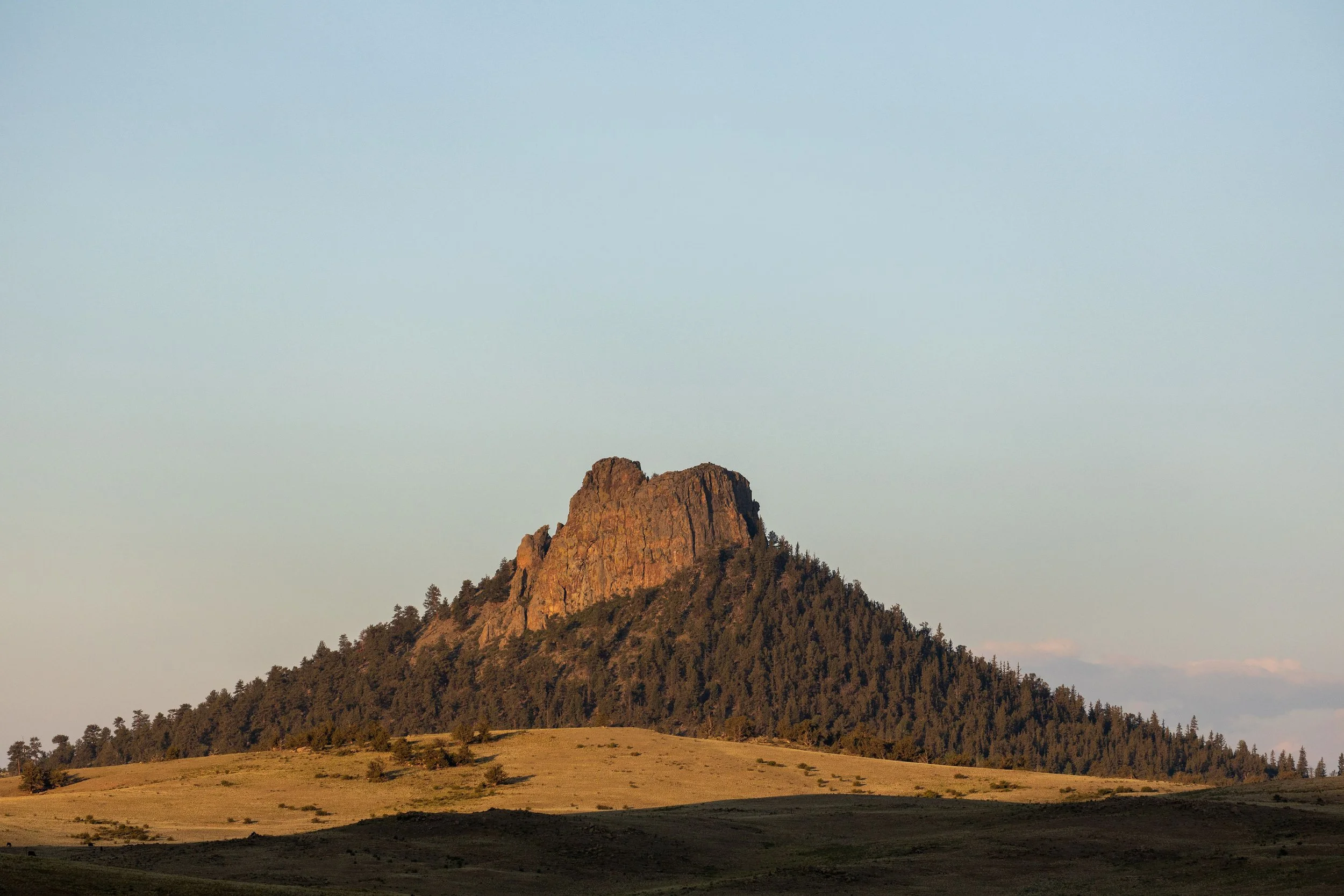
People often mistake nearby Eagle Rock and Observatory Rock as volcanic plugs, but there is no volcanic rock to be found, just the same biotitic gneiss present elsewhere in the area. I call Eagle Rock an inselberg or monadnock for its appearance as a particularly erosion-resistant plug of that rock.
The lower creek valley and associated hay meadows of the Ranch, all the way through the North Parcel of the Ranch and extending through Tarryall Reservoir and continuing down valley consist of Quaternary-age Post-Piney Creek and Piney Creek alluvium producing the Guffey and Chittum soil series as described in the CNHP Report above. Large round (i.e., water-polished) rocks found at depth throughout the hay meadows attest to the lateral extent of the Creek over time as well as its velocity. I believe that the construction of the dam associated with the Tarryall Reservoir back in the 1940’s slowed considerably the river’s descent through the canyon and created fairly significant “back pressure” on the river, thus creating more of the meandering features of the river than what perhaps previously existed. The construction of the Jefferson Lake reservoir back in the late 1800’s (upstream from the Ranch) would likely have had the same effect of reducing stream flows through the valley from what was previously experienced.
SIGNIFICANCE.
What does all this mean? Is any of this really all that important? If so, how and why?
Clearly, by knowing the location of obvious or inferred faults that facilitate underground water movement, one can improve the siting and subsequent performance of stock or domestic water wells. That can save you a fair amount of both money and aggravation, while improving livestock health, etc.
Knowing your soils is critical for historical water use analyses because it determines the rate of water infiltration, storage capacity, porosity, permeability, and evaporative loss, which directly dictate past irrigation needs, runoff rates, and groundwater recharge. Clay-rich soils retain more water, while sandy soils drain rapidly, meaning historical land use, crop types, and water consumption were heavily dependent on the soil’s physical structure. Soil structure influences how fast water moves into the soil versus creating surface runoff, which affects historical erosion studies, water partitioning and return flows. By understanding soil texture, analysts can estimate if past agricultural practices were sustainable or if they led to waterlogging (in clay) or excessive leaching (in sand). Moreover, soil permeability determines how much water is capable of percolation down to recharge aquifers versus being used by plants.
Therefore, soil maps and texture analyses are essential for reconstructing past hydrological conditions and understanding how current land management practices influence both water availability and usage.
Just as important as the practical implications of understanding the geology and soil characteristics of an area are the philosophical, cultural and conservation implications.
Gary Snyder, for example, is a Pulitzer Prize-winning American poet, essayist, and environmental writer sometimes referred as the “Poet Laureate of Deep Ecology," his writing focuses on the relationship between humans and the natural world. He insists that knowing an area's geological history is an essential component of "reinhabiting" a place—the process of becoming deeply familiar with, and responsible for, one's local bioregion.
He believes that understanding the deep time of geology, alongside ecology and local history, helps humans move away from destructive, consumerist, and "absentee" lifestyles toward a more sustainable and conscious existence.
Similarly, Joseph Wood Krutch, another writer and a contemporary of Aldo Leopold, and who was heavily influenced by him, believed that understanding an area's geological history was very valuable, recognizing that the grandeur and essentially the gravitas of landscapes like the Grand Canyon is partly found in their immense, slow-forming history.
Wendell Berry’s views on understanding geologic history are inseparable from his belief in local, intimate knowledge of the land, rather than just abstract scientific study. He views the physical earth—including its geological formations, soils, and water—as a "creature" or a "community" to which humans belong and to which they have a moral obligation.
Wendell Berry emphasizes knowing the specific history of one's own locality, which includes understanding how the land was formed, its soil composition, and its water systems. He argues that we cannot properly care for a place without understanding its past. Berry views the land as holding its own history, which is "written" in the soil and landscape. He often contrasts the destructive, fast-paced nature of industrial, short-term agriculture with the slow, patient, and long-term processes of nature, urging humans to respect the latter, arguing that people "inevitably destroy what they do not understand.”
Echoing conservation stalwarts such as Aldo Leopold, Wendell Berry believes that understanding the geological and ecological history of a place brings a responsibility to "husband" it. For Berry, this means treating the land not as a commodity to be extracted, but as a living system (a “community”) that supports life, which must be protected for future generations. His work often highlights the connection between human history and the land's geological history, believing that local culture is shaped by the landscape and that, when healthy, it forms a "community" that includes the land, its people, and its history.
Aldo Leopold himself was a student of geology, incorporating geologic perspective into numerous essays, such as the afore-mentioned “Marshland Elegy” and his “Odyssey” where he follows the journey of an atom marking time in a “limestone ledge since the Paleozoic seas covered the land.” He remarks that “time, to an atom locked in a rock, does not pass.”
By understanding our geologic history, we gain not only information that helps us run a better cow/calf and hay operation, but also an appreciation of the potential and personality of this land and associated wildlife, soil, water, and plants that call this place home. Knowing the geological history of our Ranch is thus an essential component of "reinhabiting" and dwelling in this place, in the Heidegger sense, and becoming a better and more enlightened citizen of this community.
“First there is a mountain, then there is no mountain, then there is”
REFERENCES AND NOTES
¹The term was first used by John McPhee in his book “Basin and Range.”
²The Precambrian supereon is the oldest portion of geologic time, constituting 88% of Earth’s history, is split into two eons, the earliest being the Archean eon followed by the Proterozoic eon. The next period of time is referred to as the Phanerozoic Eon, which is split into three eras (Paleozoic, Mesozoic, and Cenozoic) and twelve periods.
³ The Carnegie Museum of Natural History refers to it by both names, highlighting that it is a common term for the same, well-documented geological, and biological feature.
⁴ Chicxulub is most commonly pronounced as "CHEEK-shoo-loob" or "chick-shuh-LUHB" as it is a Mayan name, where the 'x' is pronounced like 'sh'.
⁵ The Chicxulub impact released an estimated 100 teratons of TNT (4.18 x 10²³ joules) of energy, with some estimates ranging up to 1024 to 1025 joules. This energy is equivalent to over a billion times the power of the atomic bomb dropped on Hiroshima, causing global devastation, massive tsunamis, and a "mega-earthquake".
⁶ K-Pg stands for “Cretaceous-Paleogene” boundary.
⁷ The term “Paleogene” is derived from Greek, meaning “ancient birth.”
⁸ An epoch is a division of geologic time less than a period and greater than an “age”.
⁹Common Era (CE) and Before the Common Era (BCE) are year notations for the Gregorian or Julian calendar, and are exactly equivalent to the Anno Domini (AD) and Before Christ (BC) notations. The expressions "2026 CE" and "AD 2026" each equally describe the current year; "9,700 BCE" and "9,700 BC" are the same year too.
¹⁰The resulting 150-page report, entitled “Biological Survey of Eagle Rock Ranch, Park County, Colorado” is available for public inspection and review on the CNHP website, i.e.,
https://cnhp.colostate.edu/download/documents/2023/CNHP-Eagle-Rock-Ranch-Biodiversity-Survey-Report_20240310_Combined.pdf